Practical local guide
Pram-friendly walks in Hervey Bay
A cautious guide to Hervey Bay shared paths and short walks, using council surface and facility facts without turning a flat path into a universal accessibility guarantee.
Updated 27 July 2026 · 10 min read
Fraser Coast Regional Council says most recreation trails are flat shared paths. That is a useful start, but it does not prove that every metre has a smooth surface, safe crossing, gentle gradient, open toilet or obstacle-free access.
This guide treats “pram-friendly” as a planning question, not a certification. Route details were checked from council sources in July 2026 and should be paired with a dated field check.
Esplanade shared path
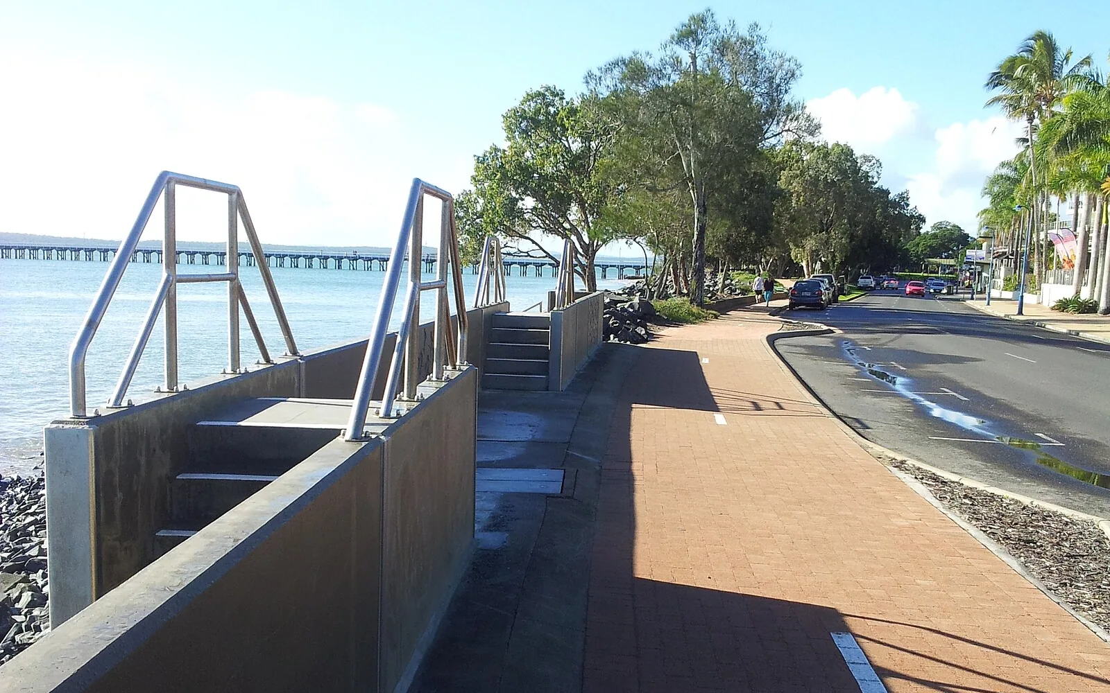
The Hervey Bay Esplanade provides the main continuous family-walk corridor. The Urangan section shown in this site’s licensed photograph has a paved path beside the road. Conditions can differ along the Esplanade.
Plan a short out-and-back rather than assuming the full route is comfortable. Check:
- path surface at the chosen start;
- road and driveway crossings;
- shade at the time of day;
- toilet and change-facility location;
- parking signs;
- temporary works;
- return distance.
For food, the kid-friendly eating guide separates “Esplanade address” from proven pram access.
Scarness foreshore
Scarness Foreshore Park has a council-listed playground, shelters, all-abilities toilets, standard toilets and showers. Council also places the beach-access ramp about 27 metres east of Enzo’s Cafe.
That makes Scarness a strong logistics lead for a short walk-plus-play plan. It does not prove the café route, crossing and seating work for every pram; check them.
Pialba foreshore cluster
The Pialba cluster includes Pialba Adventure Playground, All Abilities Playground, Seafront Oval and WetSide. Council lists substantial toilet and accessible-facility information across the area.
Because it is a cluster, decide the start and finish before leaving. A “quick walk” can become a long loop when different children want different facilities.
WetSide is seasonal and water activities need their own supervision plan. The path route and water-park visit are separate decisions.
Urangan Pier foreshore
Urangan’s foreshore and pier create a clear destination, but this guide does not claim that every pier surface, approach or full length suits every pram. Check current council access information and conditions.
For a shorter plan, view the pier from the foreshore and use an out-and-back section of the path. Avoid promising a full pier walk before checking distance, wind and the child’s tolerance.
Hervey Bay Botanic Gardens
The Hervey Bay Botanic Gardens entrance is paved and the council maintains the gardens as a public facility. The licensed launch image shows the entrance path, not every internal route.
Use council information to select a route and check:
- sealed versus unsealed sections;
- gradients;
- path width;
- toilet location;
- closures/works;
- shade and mosquitoes/insects as current conditions.
Do not describe gardens as a playground unless the council record states one.
Choose by outing length
20–30 minutes
Park close to the chosen foreshore section, walk out and back, then leave or stop for food. This works best with a toilet identified before starting.
45–60 minutes
Add one playground or garden loop. Do not add both a long path and a destination facility unless the child’s routine allows.
Longer
Break the route into segments. A continuous Esplanade path does not require walking it all. Consider heat, supplies, feeding, shade and return transport.
Path plus playground
Use council details:
- Scarness: playground, shelters and toilets;
- Pialba Adventure: extensive play, shade areas and toilets;
- Ernie Organ Park: playground, trees/shelters and toilets;
- Dayman Park: climbing-net playground, shelter and toilets;
- Black Stump Park: playground, shelters and toilets.
The playground guide lists fencing and shade facts without guessing.
Pram, wheelchair and mobility language
These are different questions. A pram can sometimes be lifted over a lip; a wheelchair route cannot be assumed from that. A wide flat path may still have an unsuitable crossing or gradient.
Use council disability-access information for an accessibility need. Call a venue for entry and toilet details. This guide does not issue access guarantees.
What to field-check for the next edition
The photo route should record:
- path material and width;
- kerbs and crossings;
- gradient changes;
- shade at a stated time;
- toilets and change facilities;
- water stations;
- parking and signed restrictions;
- construction;
- date and exact segment.
No identifiable children or adults should appear in the site photographs.
Frequently asked questions
Which is the easiest first walk?
Choose the closest short Esplanade segment with a known toilet and do an out-and-back. “Easiest” depends on the pram, adult and child, so the guide does not rank one universally.
Is the path shaded?
Shade varies by segment and time. Do not infer continuous shade from trees in a photograph.
Can I pair a walk with coffee?
Yes, but confirm venue opening and access. Scarness has the strongest council-sourced café relationship in the current data.
Are dogs or bikes relevant?
Shared-path rules and conditions belong to council signage. Check the route and keep the plan compatible with current rules.
Sources checked July 2026: Fraser Coast Regional Council recreation-trail, park and disability-access information, plus dated licensed photography.